Thu 19 Jun
Mulhacén, Sierra Nevada
[If you see this account before I've managed to add in all the photo and other links, please come back a week or two later]
Mulhacén (3482m) is the highest peak of the Sierra Nevada, and the highest in continental Spain (Teide, in Tenerife, Canary Islands, is a bit higher).
Powered by Google Earth Hacks | Map Details | Create your own!
NB: If this doesn't display, you may need to download and install the Google Earth plug-in.
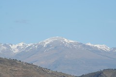
The Sierra Nevada (map, satellite photo) runs west-to-east across Andalucía, and its peaks are visible from well over 100km away on all sides. On the northern side, the major peaks provide a snow-topped backdrop to the city of Granada throughout much of the year
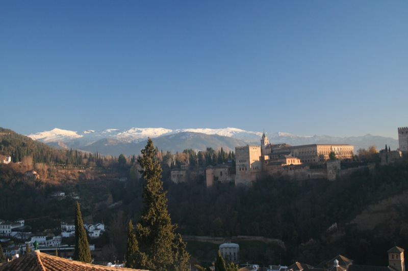
Backdrop to Granada
- whilst to the south they are also visible from many points along the coast.
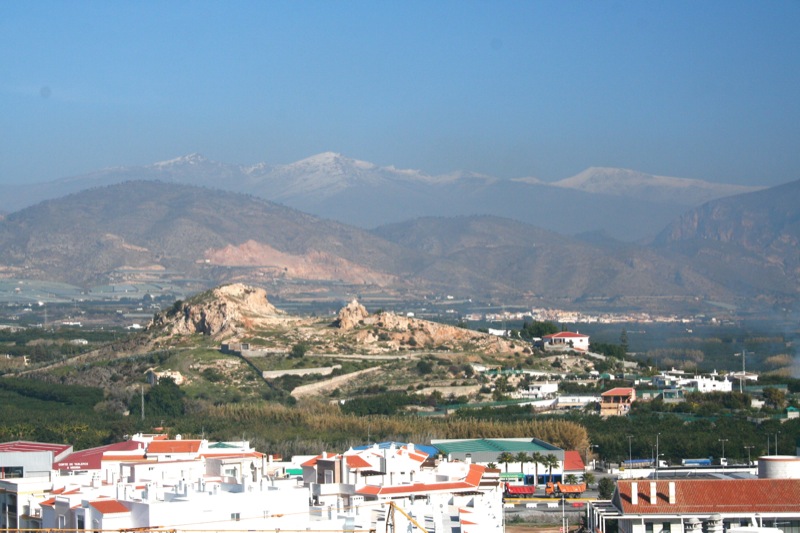
Mulhacén from Salobreña
Twenty years ago you could drive your own car up to the top of nearby Veleta, and down the other side, although the higher roads were unsurfaced, and it wasn’t exactly encouraged. Nowadays, quite rightly, the whole area is a protected National Park, and private vehicles are not allowed in.

Veleta, from halfway up Mulhacén
There are several ways to get up Mulhacén: you can walk, you can walk, or you can walk, and if you're really daft you could try scaling the North Face.

Fancy scaling the North Face of Mulhacén?
Some do it as part of a longer trek across the Sierra Nevada, over two or more days, camping out or staying in unattended mountain refuges; most go up as I did on a one-day excursion from the southern side, taking a bus part-way up, to Alto del Chorrillo (2600m), some way into the National Park, and walking the rest.
Another possibility is to drive your own car up to the entrance to the National Park, and walk from there; this gives you several hours’ more walking to get up to the top and back, although you are not then tied to the bus timetable.
The buses run from the three Poqueira Valley villages (pic) - Pampaneira, Bubión and Capileira, which is the highest at 1400m. If you just want to take the bus to Alto del Chorrillo, as several people did the day I went, at 7.50€ return the fare compares well with travelling one stop on the London Tube.
The buses are run by Nevadensis, a tour company specialising in all types of Sierra Nevada trip. My excursion cost 40€, which covered the bus and the 6-hour guided walk. Their guides are superb: highly experienced, well-qualified, and very helpful. I had good cause to be thankful for this.
I stayed overnight in Capileira, at the comfortable and inexpensive Hostal Carril (aka Paco López, aka El Cascapeñas), and joined the bus at 8.30 the following morning.
The group I went up with were coming to the end of a 10-day walking holiday with the tour company Explore, and during the previous week they had already been up to one of the other high peaks as well as doing a number of other walks, including some that I had done on previous visits to the area, such as up the Poqueira Valley (pic), and round the Tahá villages (pic) - all highly recommended.
Mulhacén and back: background - ascent - at the top - descent - been there, done that
Bloglets: full moon - single file - pause - at the top - back in Salobreña
Bloglets: full moon - single file - pause - at the top - back in Salobreña
No comments:
Post a Comment